History of the Lake
|
Bron: Geopunt.be |
Lees ineens: |
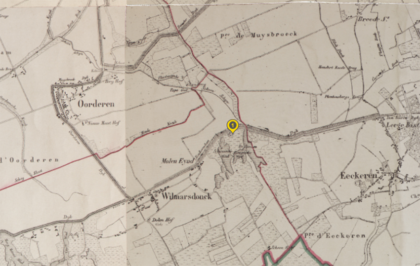
What we now know as the Put van Ekeren, Domein Muisbroek, was in the 19th century a polder, located between Hoevenen, Ekeren, Wilmarsdonk (of which you can still see the tower of the Saint Laurentius Church from the Noorderlaan) and Oorderen (approximately on the spot where later General Motors, plant 2 stood). It was a varied landscape, with higher plots, dikes and lower (marshy) areas. Where the mark is on the drawing is approximately where the parking lot ends today, at the ford to the gardens and barn.
In the period 1925-1930, the station of Oorderen was converted into a goods station "Antwerpen Noord" with connection to line 12 Antwerp-Essen. To give this area a uniform height, sand was excavated. This created the large and small lake of Ekeren. These are fed with water from the Schoon Schijn. The water was used as a water supply for the shunting station. It is said that the water was also used for the steam trains. Certainly, today with the current water hardness (35), this would no longer be possible. (See further on the construction of the havenweg how this changed)
Around 1929, several polder villages were incorporated into Antwerp
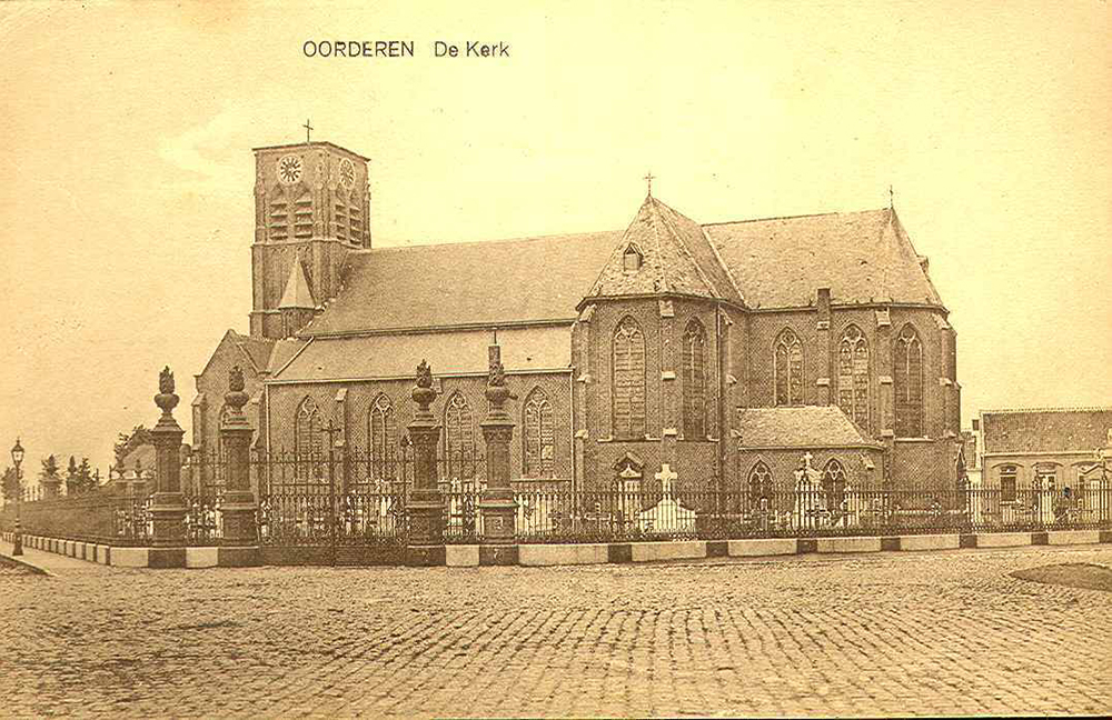
During the implementation of the so-called 10-year plan for the port of Antwerp (1956-1965), many polder villages were demolished (Wilmarsdonk: 1966, Oorderen: 1965). The land that became available was raised with sand from the newly dug docks. In this way, the port was expanded up to the Zandvliet lock (1967). During these works, the land around Muisbroek was also raised, but was never taken into use. This allowed nature to reclaim it. This forms the current Bospolder and Ekers Marsh, managed by Natuurpunt since 2002
The street leading to the parking lot, is called Ekerse Dijk. A piece of the original Ekerse Dijk can still be seen at the elevation in the extension of the parking lot. A nice article about the origins and use of this dike can be found on the website of www.schattenvanekeren.be,,the article can be found here.
Since the middle of the 18th century The Schijn was rerouted in several phases. Originally, it ran over a stretch of approximately 4.5 km to the Scheldt after Rivierenhof (across Antwerp via, among others, the Herentalsevaart, now Herentalsebaan). Today the water has to travel about 17.5 km. Finally, that water is pumped from the northern part of the Schijn (the Schoon Schijn), through the pumping station Rode Weel, formerly into the Scheldt, now into the canal dock (info integral water policy Flanders).
In 1970, the havenweg (also Zoom road, now A12) to the Leugenberg was opened. During its construction, sand from the large pit was used to build a good road foundation. This created the deeper sections in the large pit. In the process, the soil layers from the Pliocene and Miocene were broken through. It is there, where you can find many fossils, in the walls of the deeper part. The opening up of these sediment zones, full of calcareous fossils, is the reason why the hardness of the water has become so high.
The city of Antwerp rents the land from the SNCB. In 1975, permission was given to the AVOS clubs to dive in our lake.
On January 1, 1997, the concession of the large lake was given to AVOS. Since that date AVOS manages the infrastructure of the Ekeren Lake.
In 1998 a large plane bomb from WW2 was detonated in the deepest part of the large pond. As a result, the original depth of more than 21 meters was reduced to about 20 meters.
In 2018, the Muisbroek and Ekerse polder domain was transferred from the Antwerp district to the Ekeren district.
The Jetty
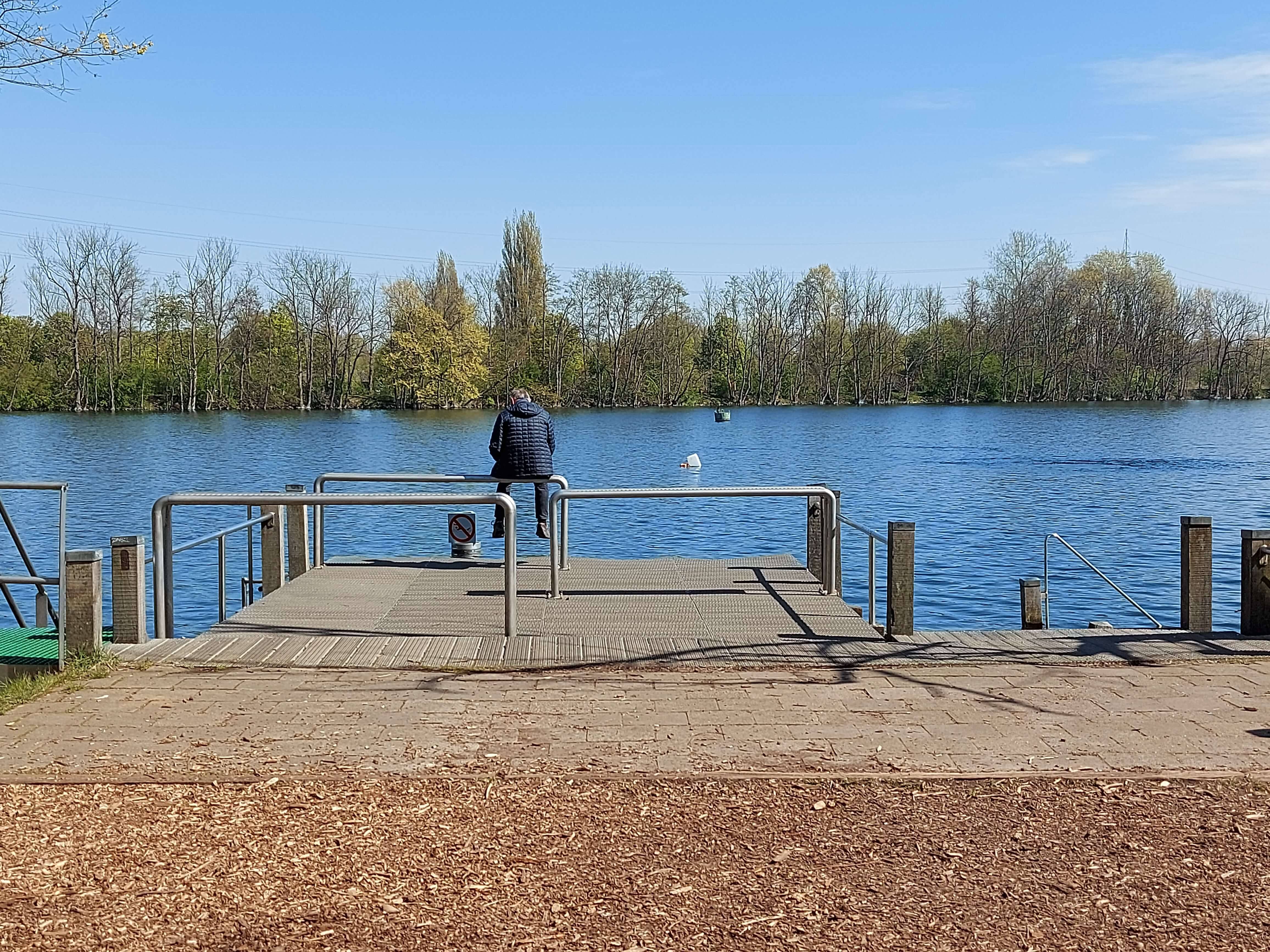
Before the jetty was built, people usually went into the water from the shore; the spot was called by many "the little beach": the inlet a few dozen meters east of the current jetty.
In 2001, the first version of the jetty was put into use: the central plateau and to get out: the left-hand stairs and the boat ladder
Later, the right side platform and the staircase connected to it were added
In 2018, the jetty received new checker plate and the left staircase was removed due to extensive wear and tear
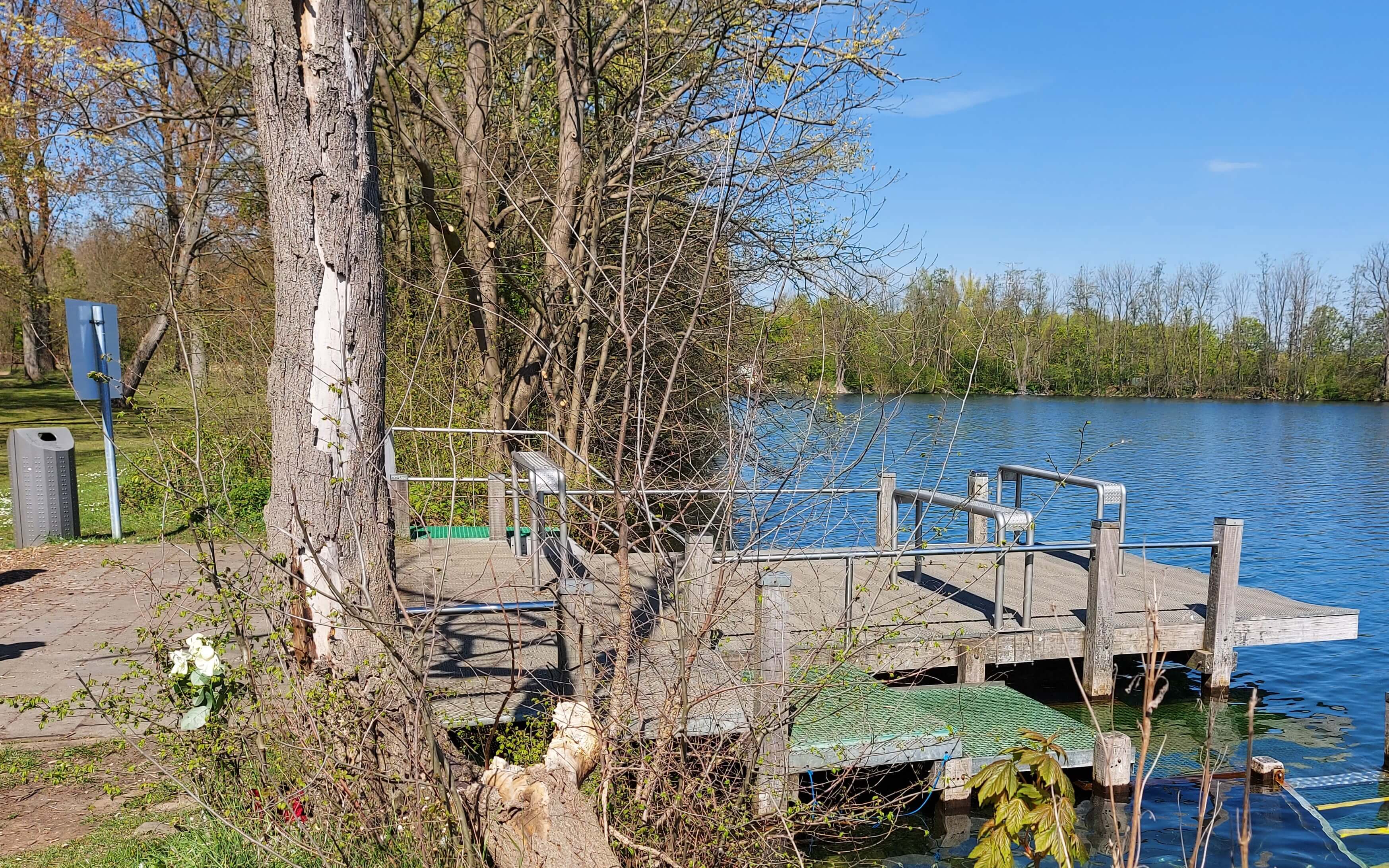
In 2020 due to corona the use of the pit became more intense, this necessitated the following repairs and improvements:
- Repairing some steps on the right staircase.
- Installation of bottle supports
- Installation of non-slip ratings on the right-hand stairs and side
platforms
In 2021, a new larger version of the left staircase was installed.
These works were carried out for free by "Bastiaens Onder Water Werken".
The entry Divers with Handicap (DWH) &
Long distance Swimmers(LDS) and triathletes
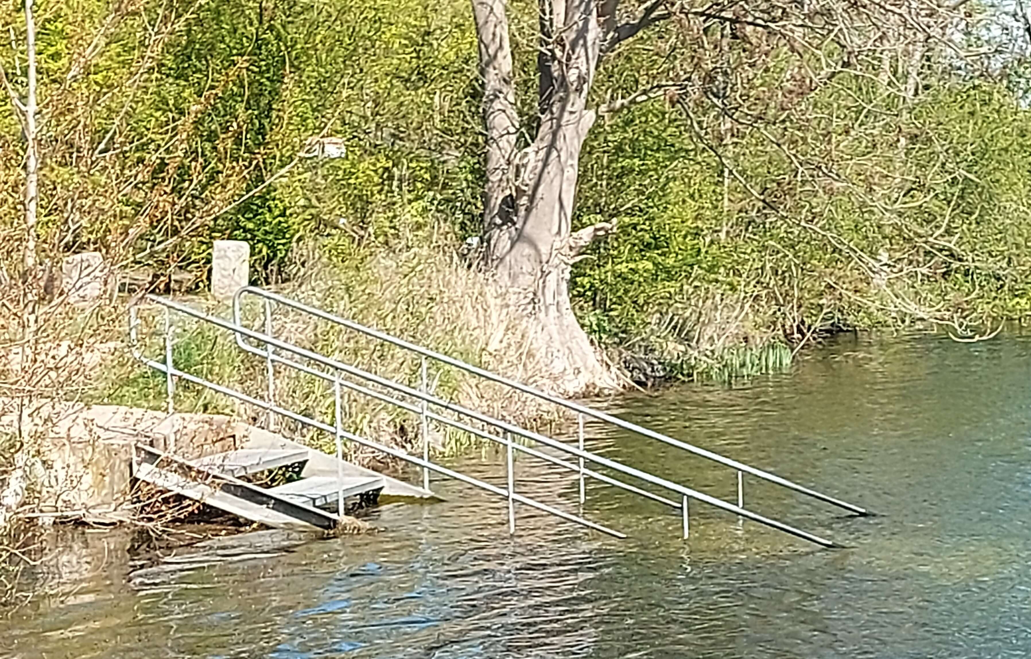
On the west side of the lake is a shed that was once used by a rowing club. To put their boats into the water, a floating jetty was constructed, which became increasingly unstable.
In 2007, this floating jetty was replaced by an extra-wide staircase so that DMH and their helpers could easily enter the water, far from the hustle and bustle of the diving jetty.
In 2020, this jetty was also designated as the starting point for long-distance swimmers and triathletes.
Other Infrastrucure
The original information board from the last years of the last century, was renewed in 2020 (the current board), the major changes being new pictures of fish and statues and on the plan of the lake the "zone reserved for fishermen" was removed: fishing is only allowed in the small lake.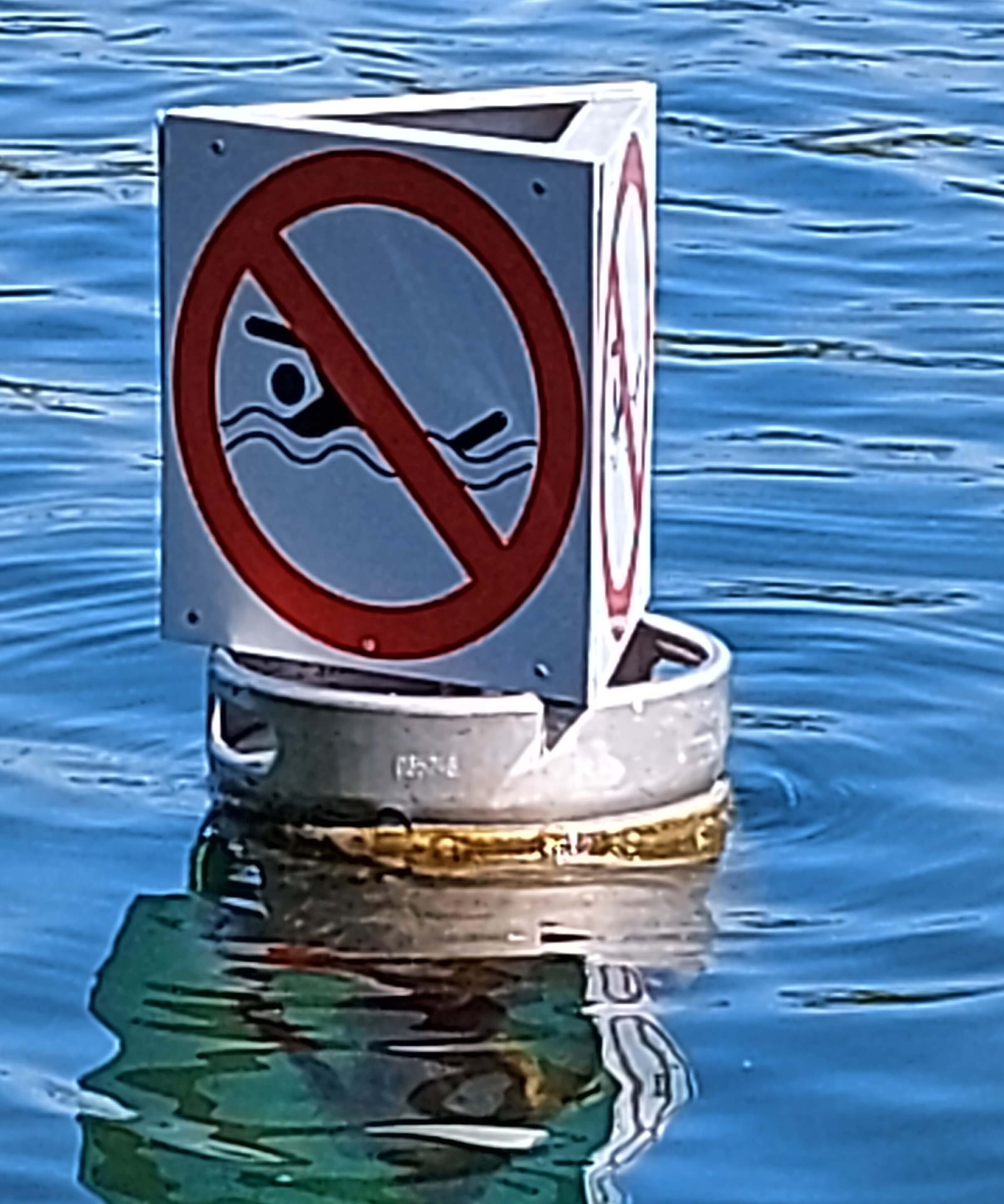
Because the "no swimming" signs were regularly vandalised, several barrels were placed in the water in 2020, a few metres from the shore, with the same sign.
At our request, Ekeren's green service lays, almost annually, a new layer of wood pulp on the path to the diving platform.
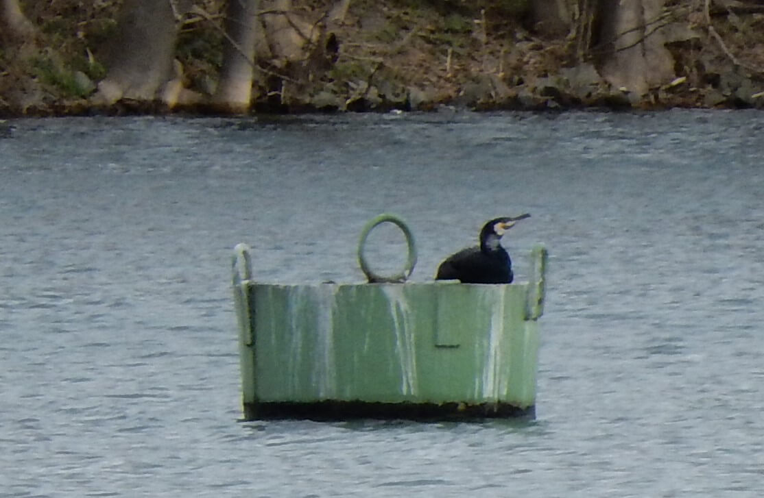 At the end of 2020 the green buoy came loose from its chain, in January 2021 it was fixed again, a few months later the chain was replaced by a new one, the old one was used as an anchor, this thanks to the free offered help of "Antwerp Underwater Solutions" in collaboration with "Questdiving".
The Pavilion
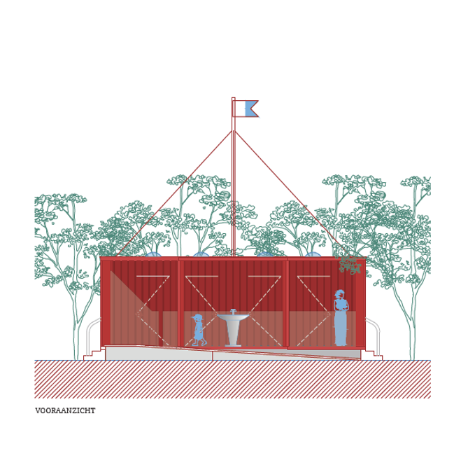
After many years of lobbying, discussions with the city and district, more concrete agreements at the end of 2019 and 2020, concrete plans were made: at our general meeting in 2021 we received a presentation in which the mayor's office proposed a plan that would be finalised by the end of 2021: the pavilion/sanitary block.
The architecture is based on the shape of a buoy with a diving flag. It houses 2 changing rooms, 2 toilets and a sink. The access control is done via the QR code of your permit. (A QR code that is already present on the permit from 2019).